The Portuguese discovered America
| Year | What |
|---|---|
| 1325 |
Brazil (different spellings are fond on maps or in documents as Brasil, Bersil, Brazir, O'Brazil, O'Brassil,
Breasail ...)appeared the first time on a map of Amgellinus Dalorto of Genoa. This will not mean that Italians
voyaged to America but they were the best cartographers at that time. The word Brazil is supposed Gaelic origine. However, in the early Middle Ages red dyewood bore the name brazil. Alexander von Humboldt believed that Brazil or Brazir recalls braise (French), braza and braseiro (Portuguese), brasero (Spanish) or braciere (Italian). They all have to do with fire, which is "red" like the red dyewood. The Duchy of Ferrara, Italy bought "grana de Brasill" grain of Brazil in 1193. Cabot was finding brazilwood during his westward explorations and it is almost certain that Brazil got his name as a tribute of such dyes. |
| 1367 |
There would have been a map of Franciscus Pizigano of Venice in which Atullia or Getulia (Antilles ?) is
discribed for the first time. |
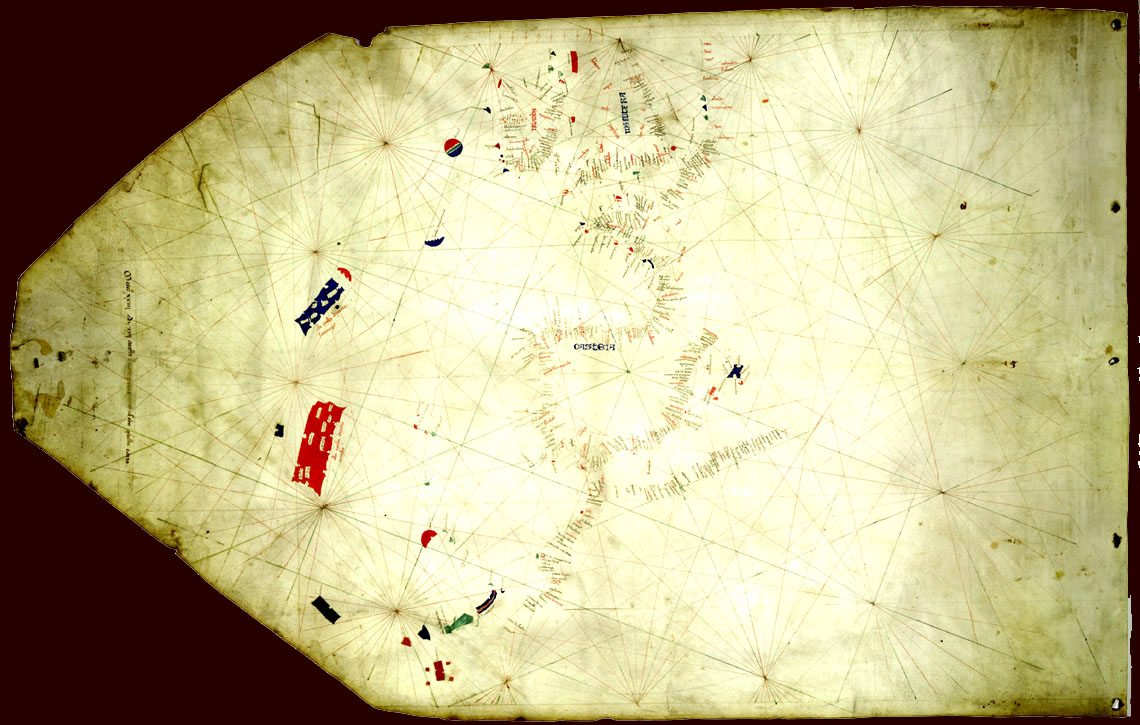
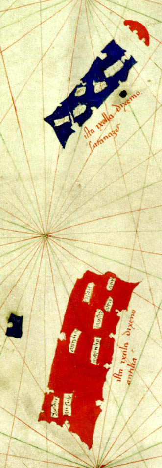
| Nautical Chart of 1424 |
The Nautical Chart was made by Zuanne Pizzigano of Venice in 1424 and is part of the James Ford Bell Library.
Antilia, Saya, Santanzes and Ymana appears on that map for the first time.
The island of Satanazes is a legendary island that appears on many maps from the 15th century. Satanezes appears in the north Atlantic Ocean, west of the Azores and north of the phantom island of Antillia also named "Isle of Seven Cities). Saya and Ymana are also phantom islands. Have these islands really been discovered or existed they only in Pizzigano's imagination? Who knows. Anyway, in two other maps prior to Columbus voyage islands in the west appears. Why when not real. Some phantom islands arose through the faulty positioning of actual islands, or other geographical errors. |
| 1452 |
Voyage of Diogo de Teive and Pedro de Velasco The Portuguese historian Jaime Cortesão believes that Teive and Velasco reached America. Theire would have been a story told to Columbus how they were searching for the Antilla island. "on the return passage they discovered the island Flores, guided by many birds which they saw flying hither, and recognized that they were land and not sea birds, and thus judged that they must be going to sleep on some land. Afterwards it's said that they sailed NE so far that they had Cape Clear (which is in Ireland) towards the E, where they found winds to blow very brisk and the winds westerly and to the sea to be very smooth, which they believed should be because the land should be there, which sheltered them to the westward; which they not follow up to explore, because it was already August and they feared [the approach of] winter. He said this happened 40 years before Christopher Columbus discovered our Indies. |
| 1466 |
Petrus Roselli's map of the 1466 shows the Antilia group of islands. Roselli was from Majorca. He or his
family was Italian origine. Actually six and probable additional two maps are known of this cartographer.
These maps date from 1447 to 1466 (respectively 1468) His map
is part of the James Ford Bell Library and can be seen on their web site. |
| 1472 |
It is believed that the Portuguese navigator João Vaz Corte-Real rechaed the "Land of the Codfish" (probably
Newfoundland. |
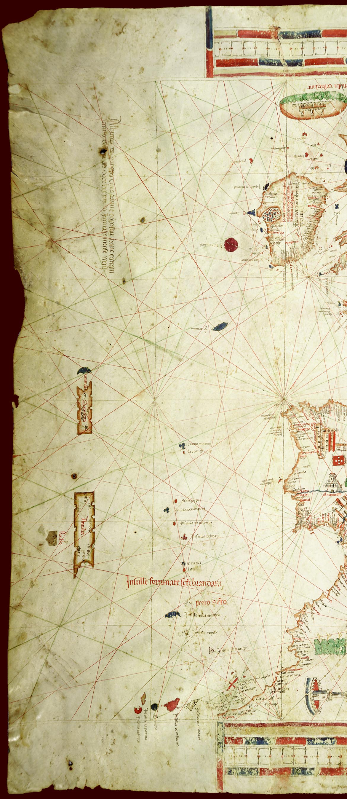
| 1489 |
On the western part of the 1489 Portolan Chart of Albino de Canepa, Genoa,
three islands, Salvagia, Antilha and Roillo appears. Very little is
known about this cartographer. His map is part of the James Ford Bell
Library and entirely can be seen on their web site. |
| 1494 |
Tordesilas treaty which splitted America into a Spanish and a Portuguese zone. The Portuguese settled mostly
in Brazil. Their attempts for North America (Canada) failed. |
| 1501 |
Miguel and Gaspar Corte-Real explored Newfoundland and Labrador. |
| 1521 |
Expedition of João Álvares Fagundes in Newfoundland and Nova Scotia. |
|
|
